Pacific Northwest El Niño Watch
How will El Niño affect the Pacific Northwest?
El Niño, the warm phase of the climate pattern known as the El Niño-Southern Oscillation, is strongest at the equator, but the ocean heat travels up the coast via internal waves known as Kelvin Waves. The warmer than average waters raise sea level (warmer water expands) and can affect biological organisms. El Niño also affects the atmosphere, influencing our Pacific Northwest weather.
Here we provide a PNW-focused view of Seawater Temperature Anomalies, Sea Surface Height Anomalies, and Biological Observations. We also offer resources to increase your Coastal Awareness and gain other El Niño Information.
Current El Niño Status - 9 November 2026 Update
- El Niño continues to strengthen, with a strong-to-very strong El Niño likely through January-March 2027
- The Multivariate ENSO Index has been 2.4-2.5 during July to September 2026. Values over 0.5 are considered warm. The highest recorded since 1979 was 2.9 in 1983.
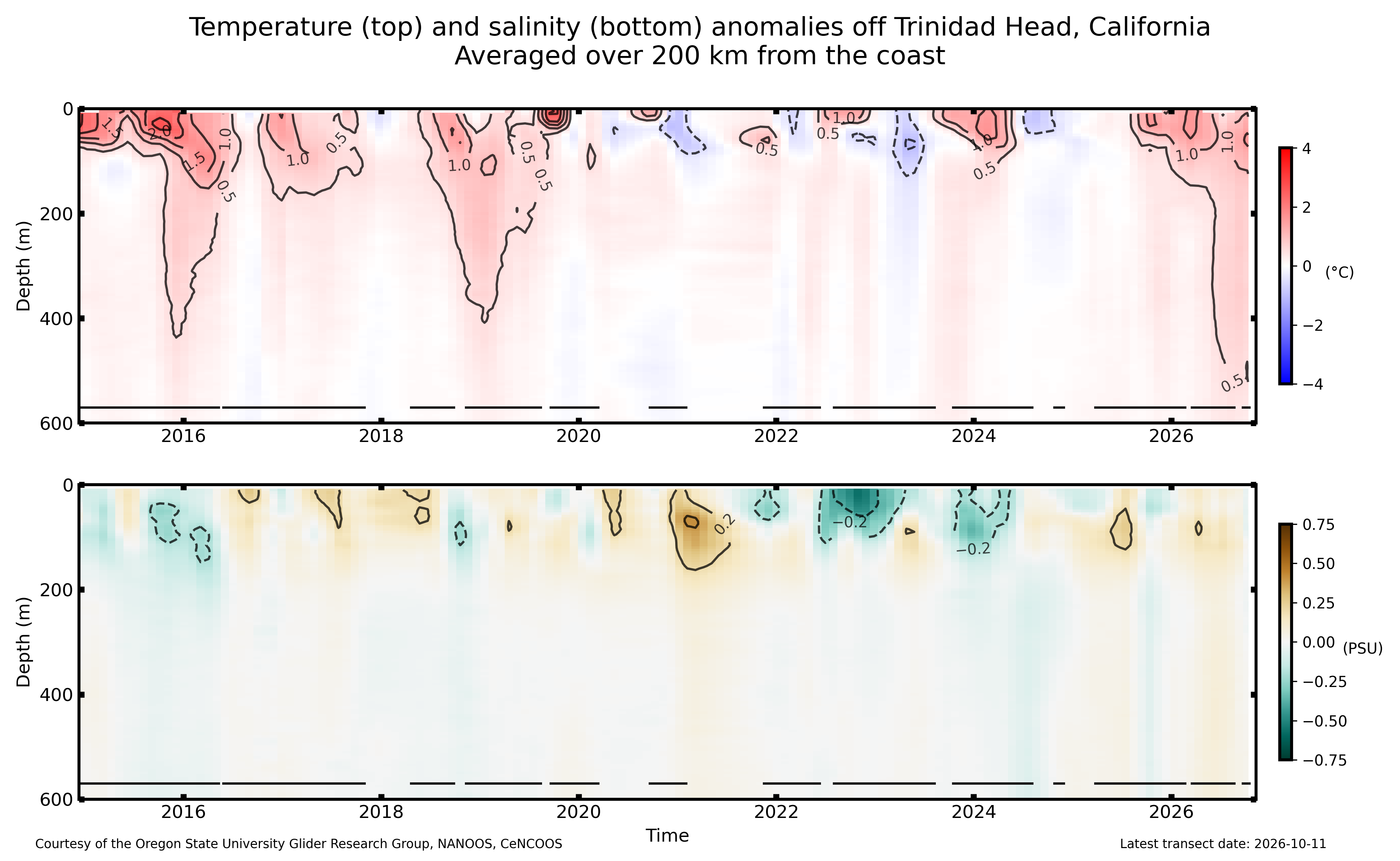
- While sea temperatures are well above normal and setting records in California, in the Pacific Northwest sea temperature anomalies are more moderate currently, though evident even to 500 m off Trinidad Head, just south of Oregon.
- Sea surface height anomalies also are moderate though at the top of their typical range.